DAG12 Drone Remote Control: 20KM Professional Smart Controller
What Makes the DAG12 Stand Out in the Field
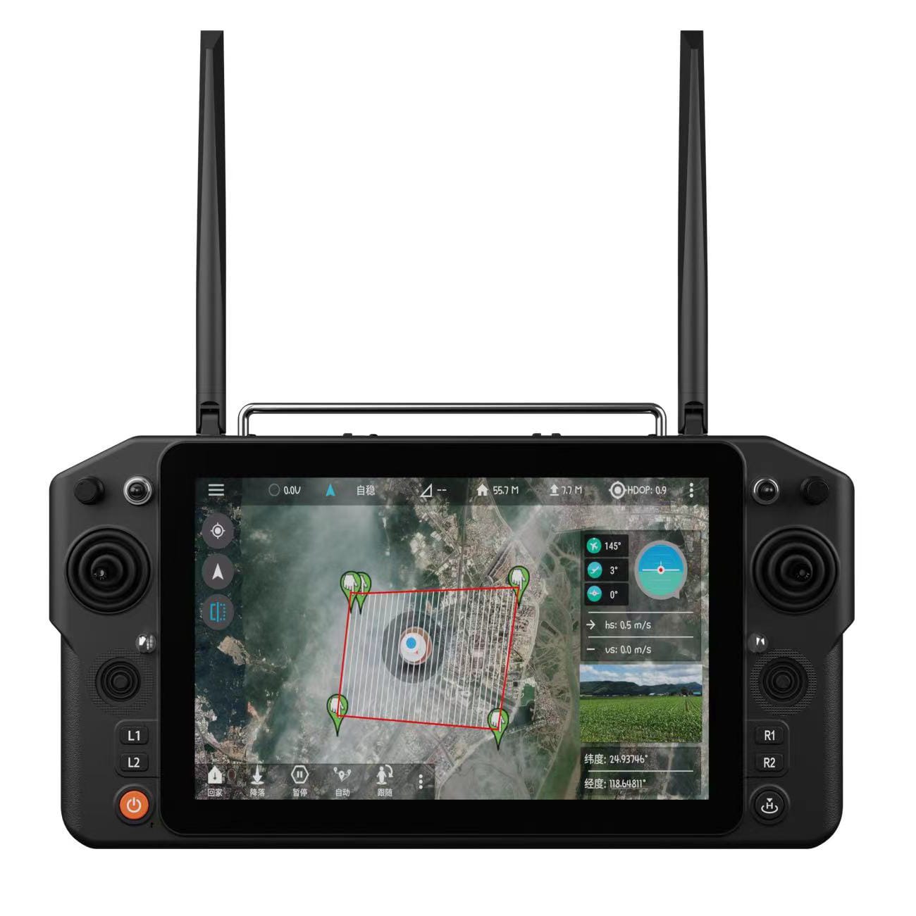
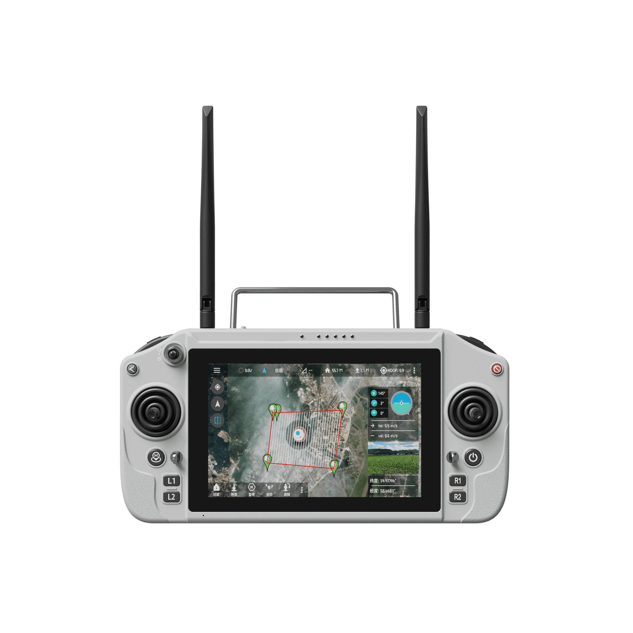
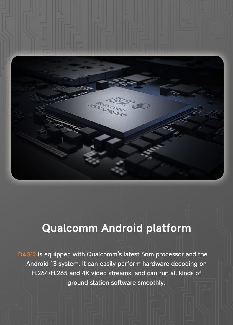
The DAG12 drone remote control combines long-distance communication, an integrated high-brightness display, and an Android-based operating platform. As a result, professional operators can manage aircraft, view live imagery, and monitor flight information from one portable device. This professional drone controller uses a Qualcomm 6nm processor with Android 13 and 4G operating memory. It also provides 64G of system storage. Moreover, hardware decoding supports H.264, H.265, and 4K video streams for compatible ground-station applications. The 5.5-inch display has a 1920 × 1080 resolution and reaches up to 1000 nits. Therefore, maps, telemetry, and transmitted imagery remain easier to read in bright outdoor environments. Its dual-band 2.4G and 5.8G system supports automatic band switching and frequency hopping. Consequently, the controller can select a lower-interference working band as conditions change. The specified ground-to-air visual control distance ranges from 5 to 20 km, depending on the operating environment and system configuration. In addition, a 10,000 mAh battery delivers a stated endurance of 4–8 hours. These capabilities make the unit a practical long range remote control for surveying, mapping, inspection, monitoring, agriculture, and search-and-rescue missions.
DAG12 Drone Remote Control Specifications
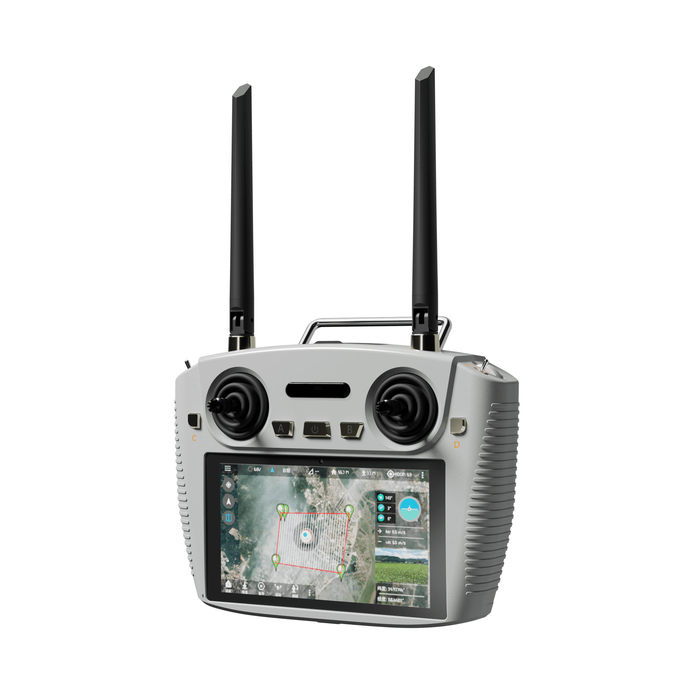
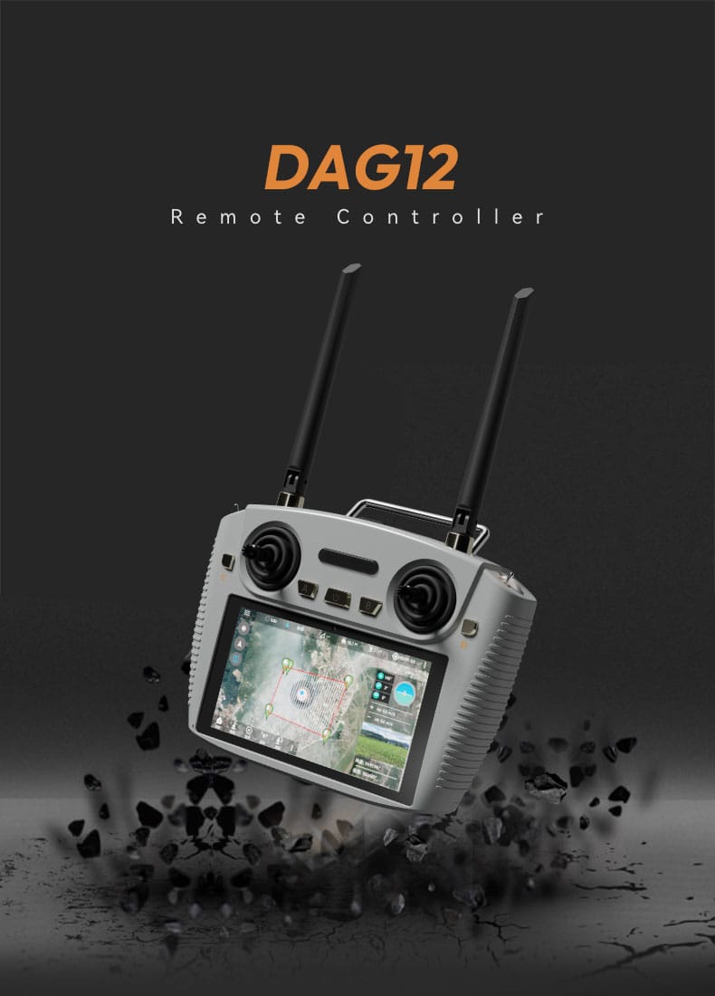
The controller has a light gray housing with dark controls, two tall antennas, and pronounced ribbed side sections. Additionally, a metal-colored upper handle supports easier carrying between work areas. The front panel includes two large joysticks, physical switches, and central A, power, and B buttons. Meanwhile, the integrated screen can present satellite maps, flight-status overlays, video imagery, markers, and defined operating areas.
| Parameter | Specification |
|---|---|
| Display | 5.5-inch high-brightness screen |
| Resolution and brightness | 1920 × 1080; up to 1000 nits |
| Processor and system | Qualcomm 6nm processor; Android 13 |
| Memory and storage | 4G operating memory; 64G system storage |
| Video decoding | Hardware decoding for H.264, H.265, and 4K streams |
| Frequency bands | 2.4G and 5.8G |
| Channels and frequency control | 12 channels; automatic frequency hopping |
| RF power | 23 dBm @ CE/FCC |
| Control distance | 5–20 km, ground-to-air and visual |
| Battery and endurance | 10,000 mAh; 4–8 hours |
| Dimensions | 194.3(L) × 282.2(W) × 94.9(H) mm |
| Weight | 683 g |
| Operating temperature | -10°C to 55°C |
| Charging interface | Type-C |
| External interfaces | Serial port, USB port, SIM card slot, and Type-C |
Operational takeaway: The stated 20 km figure is the upper end of a 5–20 km visual, ground-to-air range. However, actual performance can vary with interference, terrain, antennas, aircraft integration, and local regulations.
Stable Dual-Band Transmission Across Extended Distances
The DAG12 drone remote control combines remote control, data communication, and high-definition image transmission. Specifically, Skydroid wireless digital transmission technology supports image links over distances advertised up to 20 km. The system can automatically switch between 2.4G and 5.8G bands. Moreover, automatic frequency hopping helps it respond to changing interference levels. This design benefits a professional drone controller operating near mountains, infrastructure, or other signal-sensitive environments.
Key transmission capabilities
- Dual-band 2.4G and 5.8G operation
- Automatic frequency-band switching
- Automatic frequency hopping across 12 channels
- 23 dBm RF power with CE/FCC notation
- Integrated control, data, and image-transmission links
For instance, an inspection team can receive live imagery while maintaining aircraft control and telemetry feedback. Similarly, agricultural teams can monitor large fields without switching between separate control and viewing devices. Therefore, the combined link makes this long range remote control useful for workflows that depend on continuous visual information.
Bright Display and Android Ground-Station Support
The 5.5-inch full-HD display is designed for field use. Notably, its brightness reaches up to 1000 nits for improved outdoor visibility. The screen can display interactive maps, video feeds, telemetry, and flight-control status information. In addition, the Qualcomm Android platform supports ground-station applications and third-party software development. This flexibility allows the professional drone controller to support different mission requirements without relying on a separate mobile device.
The described DADA ground-station software supports waypoint planning and automatic mission execution. Additionally, it includes automatic following and one-click return-to-home functions. Operators can define routes through a map-based interface and review aircraft status overlays. However, available functions may depend on the connected aircraft, receiver, software configuration, and flight controller.
A clear screen and integrated mission tools help operators make faster decisions without dividing attention between multiple devices.
DAGRO1 Receiver Integration Details
The product specification material also identifies the DAGRO1 receiver. Consequently, integrators can review its electrical, physical, and communication requirements before installation. The receiver measures 45.5 × 60 × 21.5 mm and weighs 37 g. Furthermore, its 7.2–72V XT30 supply range supports varied aircraft power systems.
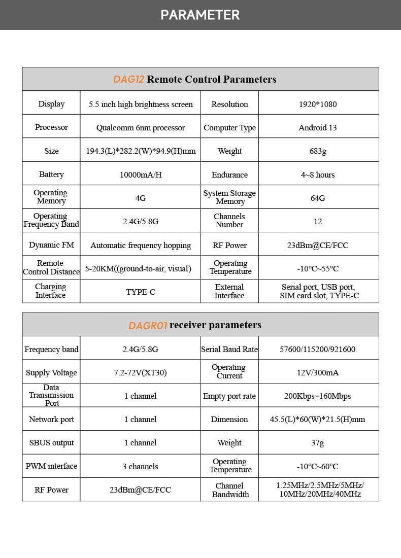
| DAGRO1 parameter | Specification |
|---|---|
| Frequency band | 2.4G / 5.8G |
| Serial baud rates | 57600 / 115200 / 921600 |
| Supply voltage | 7.2–72V through XT30 |
| Operating current | 12V / 300mA |
| Data transmission port | 1 channel |
| Data rate | 200Kbps–160Mbps |
| Network port | 1 channel |
| SBUS output | 1 channel |
| PWM interface | 3 channels |
| Channel bandwidth | 1.25 / 2.5 / 5 / 10 / 20 / 40 MHz |
| RF power | 23 dBm @ CE/FCC |
| Dimensions and weight | 45.5(L) × 60(W) × 21.5(H) mm; 37 g |
| Operating temperature | -10°C to 60°C |
Professional Applications and Field Benefits
The DAG12 drone remote control suits professional operations that require sustained communication and real-time imagery. For example, surveyors can use map-based waypoint planning for structured data collection. Inspection crews can monitor power lines, bridges, and other assets through compatible video payloads. Meanwhile, agricultural operators can review crop conditions across broad areas. Search-and-rescue teams may also benefit from the bright screen, dual-band communication, and extended endurance.
- Surveying and mapping: Plan routes and monitor flight progress through compatible ground-station software.
- Infrastructure inspection: Receive transmitted imagery while maintaining aircraft control and telemetry.
- Agricultural monitoring: Observe large fields and review crop conditions from the air.
- Search and rescue: Maintain visual feedback during time-sensitive operations in dynamic terrain.
- Surveillance and monitoring: Use a portable long range remote control for extended field assignments.
Finally, the 683 g controller remains portable enough for mobile teams. Its Type-C charging connection also simplifies power management. Nevertheless, users should confirm aircraft compatibility, receiver integration, local radio requirements, and permitted operating distances before deployment.
Why it stands out: This professional drone controller brings a bright display, Android applications, dual-band links, and extended battery endurance into one field-ready system.
For operators seeking integrated control and viewing capabilities, the DAG12 drone remote control offers a balanced combination of range, processing power, and connectivity.