
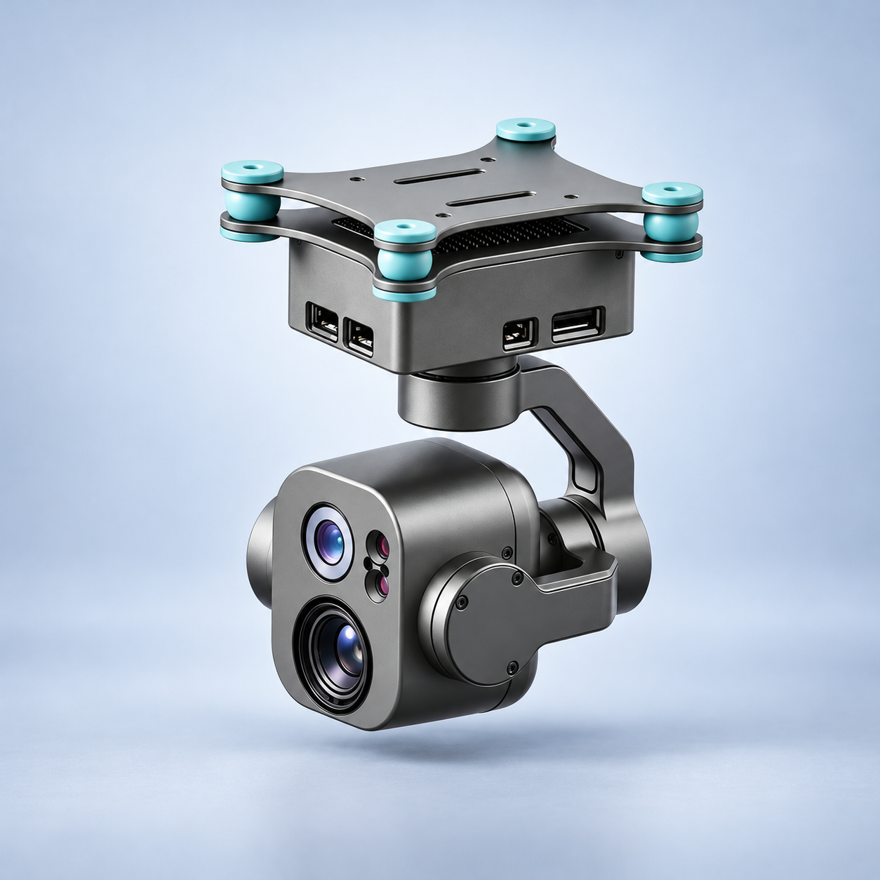
DA531 Three-Axis EO/IR Gimbal | 2.5K, Thermal & Laser
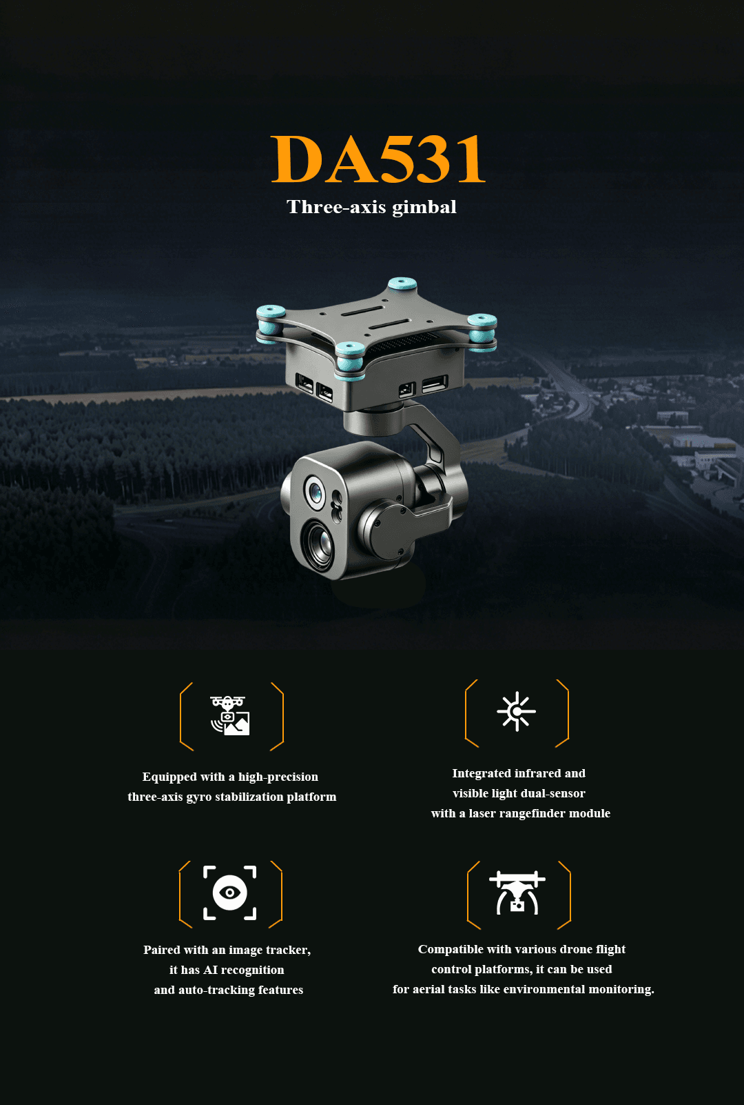
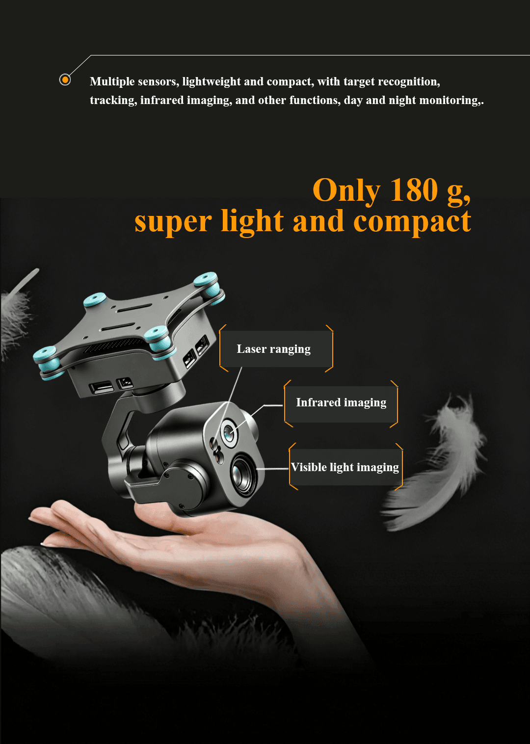
DA531 is an approximately 180 g three-axis stabilized EO/IR gimbal combining a 2.5K visible-light camera, thermal imaging, a laser rangefinder and AI-assisted recognition. It supports picture-in-picture viewing, vehicle and person tracking, distance measurement and target-coordinate output. The compact payload is designed for UAV reconnaissance, infrastructure inspection, environmental monitoring, public-safety operations and day-and-night observation.
- Approx. 180 g
- High-precision three-axis gyro stabilization
- 5 MP
- 1/1.8 inch
- 6 mm
- 49.8° (H) × 29.3° (V) × 57.8° (D)
- 2560 × 1440 @ 50 fps
- 10×
- Not supported
- 2560 × 1440
- TF card, up to 256 GB
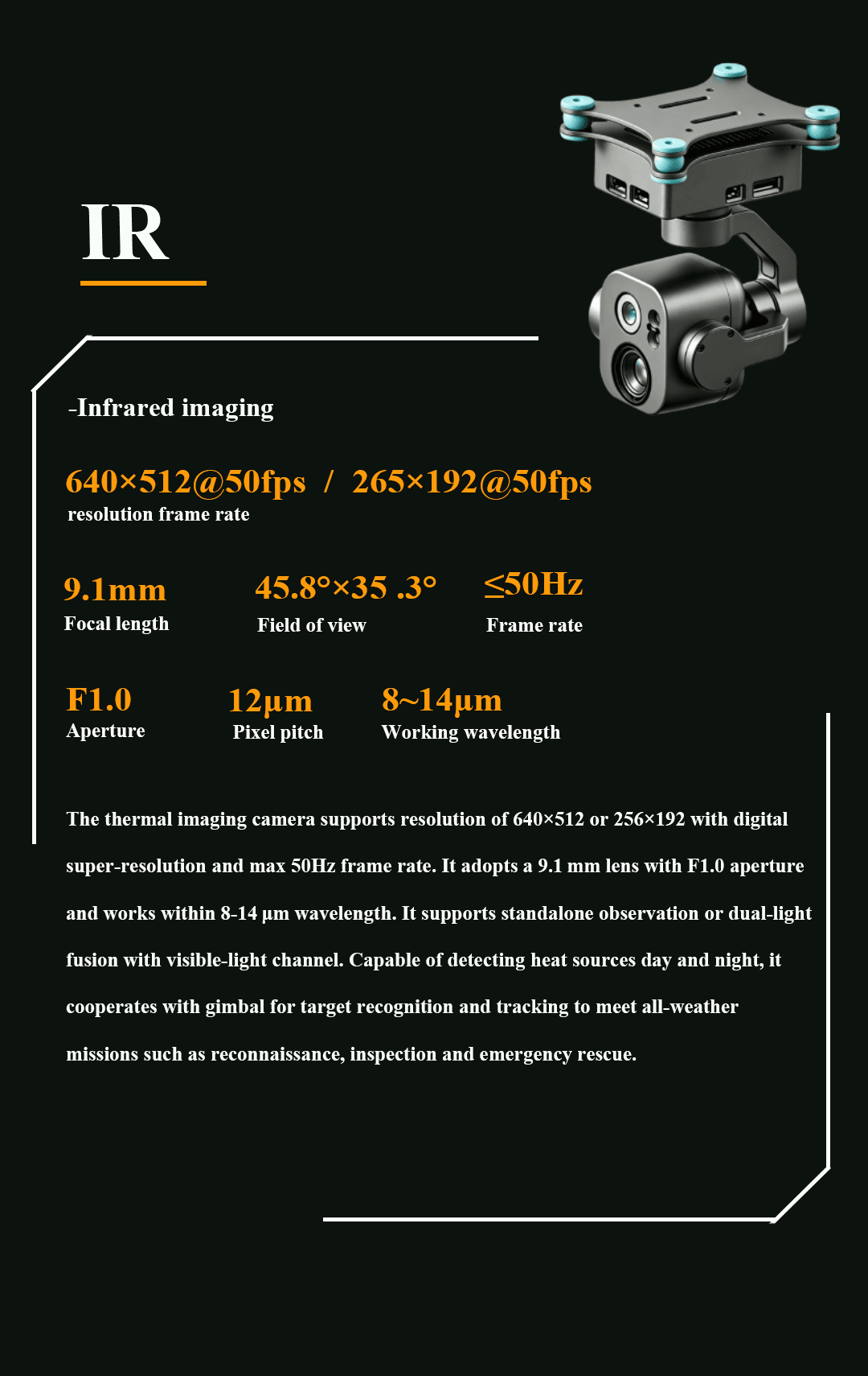
- 640 × 512 / 256 × 192
Plan your product inquiry.
Add this product to your quote list or contact our team to discuss product selection and integration.
Core specifications

Technical data
| Parameter | Specification |
|---|---|
| Product Model | DA531 |
| Product Type | Three-axis EO/IR UAV gimbal |
| Weight | Approx. 180 g |
| Stabilization Platform | High-precision three-axis gyro stabilization |
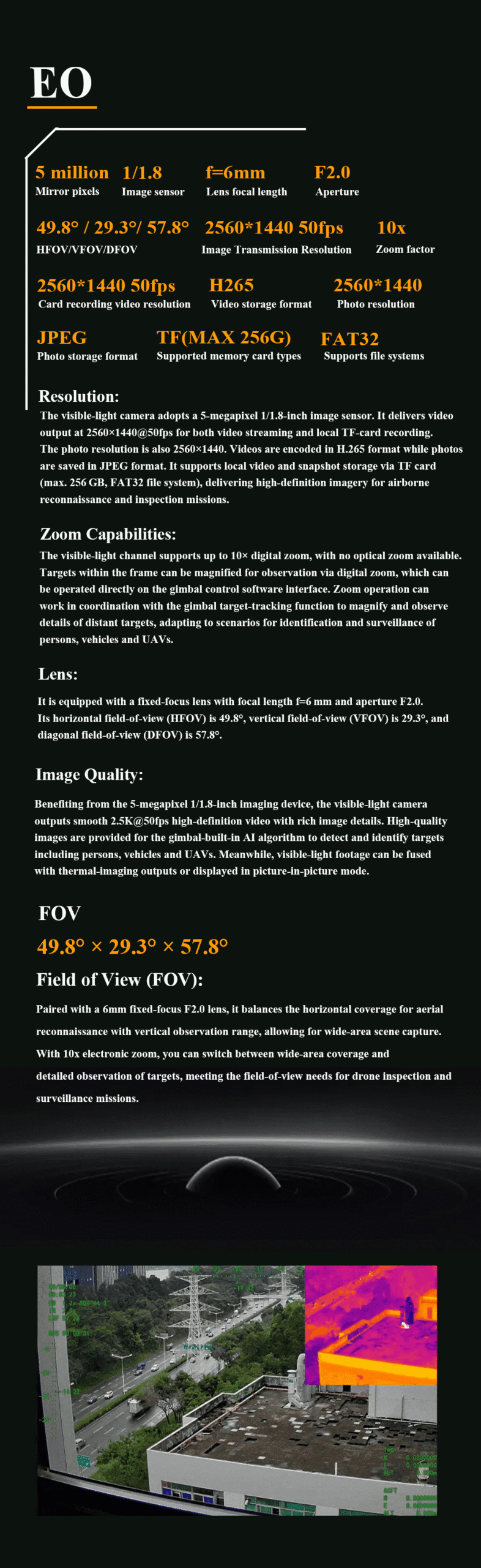
| Visible-Light Sensor Resolution | 5 MP |
| Visible-Light Sensor Size | 1/1.8 inch |
| Visible-Light Focal Length | 6 mm |
| Visible-Light Aperture | F2.0 |
| Visible-Light Field of View | 49.8° (H) × 29.3° (V) × 57.8° (D) |
| Video Transmission Resolution | 2560 × 1440 @ 50 fps |
| Local Recording Resolution | 2560 × 1440 @ 50 fps |
| Digital Zoom | 10× |
| Optical Zoom | Not supported |
| Video Encoding | H.265 |
| Photo Resolution | 2560 × 1440 |
| Photo Format | JPEG |
| Memory Card | TF card, up to 256 GB |
| File System | FAT32 |
| Infrared Resolution | 640 × 512 / 256 × 192 |
| Infrared Frame Rate | Up to 50 Hz |
| Infrared Focal Length | 9.1 mm |
| Infrared Field of View | 45.8° × 35.3° |
| Infrared Aperture | F1.0 |
| Pixel Pitch | 12 μm |
| Working Wavelength | 8–14 μm |
| Dual-Light Fusion | Supported |
| Laser Ranging Distance | 5–1000 m |
| Laser Ranging Accuracy | ±1 m |
| Measurement Frequency | 1–5 Hz |
| Target Coordinate Output | Supports target latitude and longitude output |
| Object Recognition | Vehicle and human recognition |
| Automatic Target Tracking | Supported |
| Picture-in-Picture | Supported |
| Rich OSD | Camera, target, and platform information |
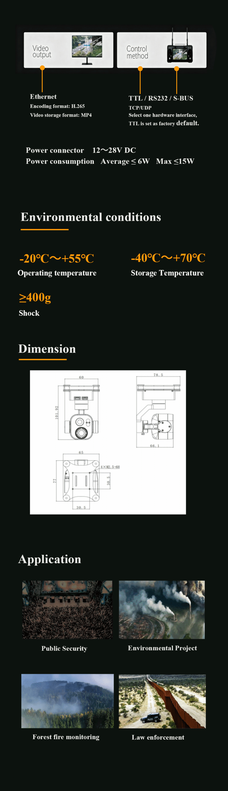
| Video Output Interface | Ethernet |
| Video Storage Format | MP4 |
| Control Interface | TTL / RS232 / S.BUS |
| Network Protocol | TCP / UDP |
| Default Control Interface | TTL |
| Power Supply | 12–28 V DC |
| Average Power Consumption | ≤6 W |
| Maximum Power Consumption | ≤15 W |
| Operating Temperature | -20°C to +55°C |
| Storage Temperature | -40°C to +70°C |
| Shock Resistance | ≥400 g |
1. Features & applications
The DA531 is a lightweight three-axis EO/IR UAV gimbal integrating a visible-light camera, infrared thermal imaging sensor, laser range finder, and intelligent target tracking functions. Weighing approximately 180 g, the compact gimbal combines a high-precision three-axis gyro stabilization platform with 2.5K visible-light imaging, thermal imaging, laser ranging, picture-in-picture display, and AI-assisted object recognition. The system supports vehicle and human target tracking, target distance measurement, and target coordinate output, making it suitable for UAV aerial reconnaissance, inspection, public security, environmental monitoring, emergency response, and day-and-night surveillance missions.
2. Product Features
-
High-Precision Three-Axis Gimbal:
Uses a three-axis gyro stabilization platform to provide stable airborne imaging and observation. -
EO/IR Dual-Sensor Imaging:
Integrates a visible-light camera and infrared thermal imaging sensor for day-and-night UAV surveillance. -
5 MP Visible-Light Camera:
Features a 1/1.8-inch 5-megapixel image sensor capable of 2560×1440 video output at up to 50 fps. -
10× Digital Zoom:
The visible-light channel supports up to 10× digital zoom for detailed observation of distant targets. -
640×512 Thermal Imaging:
Supports 640×512 or 256×192 thermal imaging with frame rates up to 50 Hz for day-and-night heat-source detection. -
Dual-Light Fusion:
Supports standalone infrared observation or combined operation with the visible-light channel for improved situational awareness. -
Laser Range Finder:
Provides laser ranging from approximately 5 m to 1000 m with ±1 m ranging accuracy. -
Target Coordinate Output:
Supports output of target latitude and longitude information for UAV reconnaissance and positioning applications. -
AI Object Identification and Tracking:
Integrated image tracking supports automatic recognition and tracking of vehicles and people. -
Picture-in-Picture Display:
Supports simultaneous display of visible-light and thermal imaging information. -
Rich OSD:
Supports overlay of camera information, target information, and UAV or platform information. -
Lightweight UAV Payload:
At approximately 180 g, the DA531 is suitable for small and medium UAV platforms where payload weight is critical. -
High Environmental Durability:
Supports -20°C to +55°C operating temperatures and ≥400 g shock resistance.
3. Application Scenarios
-
UAV Aerial Reconnaissance:
Combines 2.5K visible-light imaging, thermal imaging, stabilized observation, and target tracking for aerial reconnaissance missions. -
Day and Night Surveillance:
EO/IR dual-sensor imaging enables observation during daylight, darkness, and challenging visibility conditions. -
Target Ranging and Geolocation:
The integrated laser range finder can measure target distance and support target latitude and longitude output. -
Vehicle and Human Tracking:
AI-assisted recognition and image tracking support automatic detection and continuous tracking of people and vehicles. -
Public Security:
Suitable for UAV security patrol, event monitoring, urban surveillance, and observation of important areas. -
Environmental Monitoring:
Supports aerial environmental inspection, thermal anomaly observation, and remote monitoring. -
Forest Fire Monitoring:
Thermal imaging can assist UAV operators in identifying heat sources and monitoring potential fire areas. -
Emergency Rescue:
Infrared imaging can assist with heat-source detection and aerial search operations during emergency response missions. -
Law Enforcement:
Suitable for airborne patrol, remote inspection, target observation, ranging, and tracking applications.
Related Products
-
 DSQ09
DSQ09Aurora Mini DSQ09 Infrared Core Module
Cameras -
 DC3
DC3DC3 FHD EO Camera 3-Axis Micro UAV Gimbal for Target Tracking
Cameras -
 DC2
DC2DC2 3-Axis IR Thermal Imaging Target Tracking Micro UAV Gimbal Camera
Cameras -
 DC1
DC1DC1 3-Axis Dual Visible FHD EO Optical Zoom Micro UAV Gimbal Camera
Cameras -
 DC0
DC0DC0 3-Axis Dual 4K EO Optical Zoom Micro UAV Gimbal Camera
Cameras -
 HI640S
HI640S Uncooled Infrared Thermal Imaging Module
Cameras -
 DAI640Pro
DAI640Pro Uncooled Infrared Thermal Imaging Module
Cameras -
 DAI640G
DAI640G Uncooled Infrared Thermal Imaging Module
Cameras